This Annapurna Base Camp trek map and route guide explains how the trail flows from the lower villages into the Annapurna Sanctuary. It shows the main route, key junctions, and common entry and exit options to help you understand the trek clearly for 2026.
Annapurna Base Camp Trek Map and Route Guide (Updated for 2026)
Table of Contents
Most trekkers look for an Annapurna Base Camp trek map to understand one simple thing: how the route actually flows. With multiple starting points, villages, and route names, the trail can feel confusing without a clear visual reference.
This guide explains the Annapurna Base Camp route directly using the trek map. It shows where the trail begins, how it moves through the valley, where different routes merge, and how trekkers reach Annapurna Base Camp before descending. The focus here is on route clarity, not itinerary planning.
Quick Overview of the Annapurna Base Camp Route
Region: Annapurna Conservation Area
Trail Type: Out-and-back with route variations
Highest Point: Annapurna Base Camp (4,130 m)
Main Junction: Chhomrong
Core Trail: Shared sanctuary route after Chhomrong
The map shows one main trail into the Annapurna Sanctuary, with flexible entry and exit points in the lower section.
If you’re planning expenses next, you can also check a detailed Annapurna Base Camp trek cost breakdown for 2026.
How to Read the Annapurna Base Camp Trek Map
The solid trekking line on the map shows the walking trail, while road sections indicate driving routes such as Kathmandu to Pokhara and Pokhara to Nayapul.
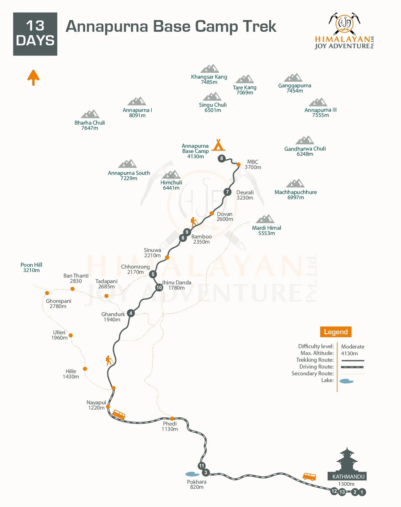
Village names are marked with altitudes, which are more important than distance. These altitude points show how the trek gains height gradually rather than through sudden climbs. Once the route reaches Chhomrong, the trail becomes a single, well-defined path toward Machapuchare Base Camp and Annapurna Base Camp.

Annapurna Base Camp Trek - 13 Days
Starting fromUS$1200US$1400
Annapurna Base Camp Route Explained (By Trekking Phase)
Starting Point and Entry into the Trail
(Kathmandu, Pokhara, Nayapul and Ghandruk)
The journey begins with a drive from Kathmandu to Pokhara, followed by another drive to Nayapul. Trekking starts from Nayapul at a low altitude, allowing an easy transition into daily walking.
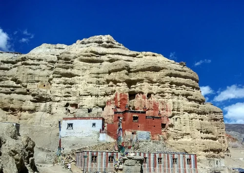
From here, the trail climbs toward villages such as Ghandruk. This section introduces trekkers to village paths and stone steps, with steady elevation gain rather than steep ascents.
Villages to Valley Route
(Ghandruk / Nayapul, Chhomrong, and Bamboo - Deurali)
From Ghandruk, the trail moves toward Chhomrong, a key junction where most routes merge. After Chhomrong, the path drops to the river and climbs again through Bamboo and Dovan.
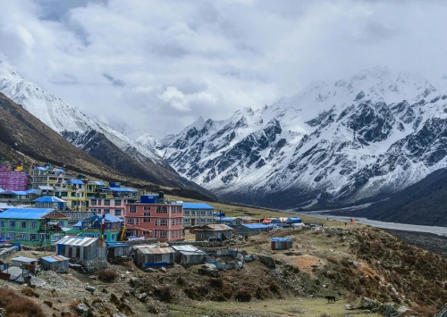
This section follows the Modi Khola valley, with denser forests, fewer villages, and a gradual increase in altitude. By the time trekkers reach Deurali, the environment feels colder and more open, signaling entry into higher terrain.
Upper Sanctuary Route
(Deurali, Machapuchare Base Camp, and Annapurna Base Camp)
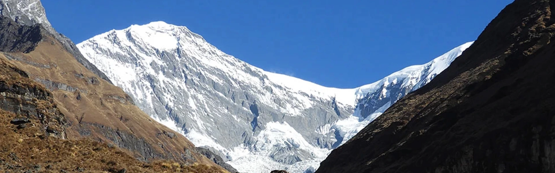
Above Deurali, the trail enters the Annapurna Sanctuary. The landscape opens into a wide alpine valley, and walking becomes slower due to altitude rather than steep terrain.
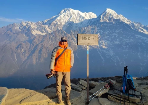
Machapuchare Base Camp sits just below Annapurna Base Camp and is a common stopping point. From here, the final walk to Annapurna Base Camp is short and gradual, leading to the highest point of the trek at 4,130 meters.
Return Route and Exit
(Annapurna Base Camp, Chhomrong, and Jhinu Danda)
The return follows the same valley back down, with altitude decreasing steadily. Many trekkers choose to exit via Jhinu Danda, which offers a gradual descent and access to natural hot springs before returning to Pokhara.
Understanding the Altitude Profile
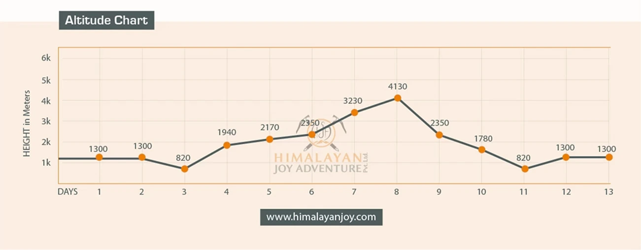
The altitude chart below the map shows a steady ascent from the lower villages to Annapurna Base Camp, followed by a gradual descent. There are no sudden altitude jumps on the route, which explains why acclimatization on the Annapurna Base Camp trek is generally smooth when the trail is followed at a normal pace.
Main Annapurna Base Camp Route vs Route Variations
There is one main sanctuary route to Annapurna Base Camp. Different routes only affect how trekkers enter or exit the trail.
Ghandruk Route: Common entry option
Jhinu Danda Route: Common exit option
Scenic Extensions (e.g., Poon Hill): Optional add-ons outside the sanctuary
All routes merge near Chhomrong and follow the same trail to Annapurna Base Camp.
For those looking for a complete guided experience, you can view our Annapurna Base Camp trek 13 days package.
Final Thoughts
The Annapurna Base Camp trek map clearly shows a single core route into the Annapurna Sanctuary, with flexible entry and exit options in the lower section. Understanding this layout makes the trek easier to plan and removes confusion around route names and variations.
For 2026, using the map as a reference helps trekkers focus on the flow of the trail rather than individual stops. Once the route is clear, planning the journey becomes simple and predictable.
Tika Bahadur Rai (Trek & Tour Leader)
Call us on WhatsApp+977 9851031957OrChat with us